The rural parish of Luppitt is protected by the Blackdown Hills Area of Outstanding Natural Beauty (AONB), any development within the parish is controlled by the East Devon Local Plan, and other organisations such as Natural England, the Environment Agency and Devon County Council influence the way we live – so why do we need a Neighbourhood Plan?
The potential for unwanted change
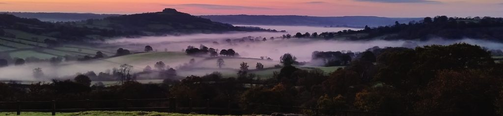
Luppitt is a quiet farming parish that has seen little change for centuries but for a variety of social and political reasons the parish community is now facing a raft of new challenges.
The sustainable community that once relied upon its mixed farms for food and employment is now wholly dependent upon transport for its basic needs – healthcare, leisure, schooling, food and employment. Parish facilities have diminished, and like many other rural areas the population is ageing, there is little or no housing suitable for the elderly or the young, and there are very few local employment opportunities. The character of the community is also changing as incomers now far outweigh local families and many properties have become holiday cottages or weekend homes.
Beyond the parish boundaries pressures are building. ‘Brexit’ signals the prospect of farming without subsidy. How will the smaller hill farms survive? What is the future for our farmland and unique Luppitt landscape and how will it absorb farming diversification? To meet population growth[1] and social change, the government is targeting the construction of 300,000 new houses in the UK each year. This is filtering down to local authorities and to ensure that Devon plays its part, the new Greater Exeter Strategic Plan will take precedence over the existing Local Plans to determine just how many houses are to be built in this region. The population of Devon is expected to grow by 67,000 over the next ten years and the government is currently projecting the need for a further 53,000 new houses to meet this demand.
The extent to which Luppitt will be affected by all this is unclear but the Luppitt Neighbourhood Plan consultation process provides the forum for open discussion and debate. It is an opportunity to make clear what the people of Luppitt think about these issues and to establish policies that address them and protect the parish for future generations.
Neighbourhood Plans – An Outstanding Opportunity
Neighbourhood Plans were introduced under the Localism Act 2011 to enhance local community rights and devolve some planning power to parish level. In essence Neighbourhood Plans offer three benefits. First, they provide communities with greater power to protect the local landscape, environment and habitats and to establish new ‘Local Green Space’ where it is warranted. Second, they offer the opportunity to establish new planning policies, specifically for the parish, which are determined by the community and would give Luppitt a much stronger voice through its Parish Council to control unwanted development. Third, Neighbourhood Plans give the opportunity for communities to formalise civic proposals and aspirations that could improve life for everyone in the community. Examples could include a community orchard, allotments or perhaps a community owned renewable energy scheme.
Neighbourhood Plan v Parish Plan
The Luppitt Neighbourhood Plan is quite different from the Luppitt Parish Plan that was produced in 2009. The Luppitt Parish Plan contains the responses to a parish-wide questionnaire circulated in 2007 resulting in a number of agreed community actions. The Luppitt Neighbourhood Plan on the other hand is essentially a planning document, which together with the East Devon Local Plan, will form the ‘development plan’ for the area. It is a legal document that can only be adopted by a parish-wide referendum following extensive consultation. It will then convey statutory planning rights to the community. Examples of Neighbourhood Plans that have been adopted in this area include Dunkerswell, Stockland, East Budleigh, Chardstock, Yarcombe, Budleigh Salterton and Ottery St Mary.
[1] UK population over 50m in 1950 and over 65m in 2018